


Trails
The mine level at Litlabø is an excellent starting point for forest and mountain hikes.
The nearest woodland areas contain a great variation of plant life, beautiful scenery and a number of visible cultural memories of mining days.
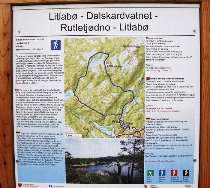
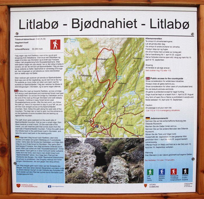
Old shafts dating from the early mining period from 1865 to 1900 are numerous. In those days the Pyrite ore at Litlabø was mined by blasting and excavating downward from the surface. In 2004 Venelaget cleared several of the footpaths in the mining area. In some places an entirely new path was made, as the old one was too soggy. Routes of varying lenghts have been marked on map billboards and by marked stakes in the ground. Every footpath alternative has got its own colour. The map showing the various routes has been posted on the wall of the captains office, beside the hoist building. Where one path crosses Stordalselvo benches have been placed.
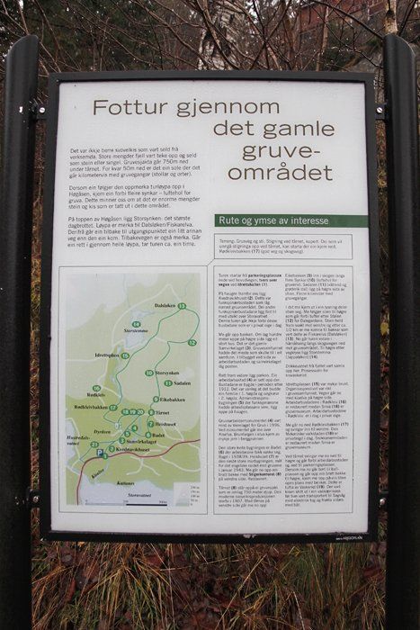
The map is set up by the previous Washery plant when entering the mining area. There is also a map at the "Stiger kontoret", where the trail to Høgåsen begins.
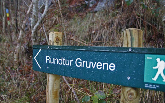
Stord Fitjar Turlag has set up signs that show the way to the trails. In the forest, the trails are marked on poles with different colors, such as the pole in the upper left corner.
Trip suggestions
Venelaget has also cleared a path up to Storsynken (The Large Shaft) at Høgåsen. It is an impressive 150 meter-long example of surface mining, dating back to the 1870s and 80s. Besides, we have cut down trees on the inside of the fence to enable the public to study this mighty man-made gap in the scenery.
A walk along the paths may well be combined with a hike in the mountains. From the crossing west of Stordalselvo you follow the tractor path and continue to the Dalskarvatnet. From there are you have a number of alternative tracks into the Stord mountains. Dalskarvatnet has been regulated by a dam in either end. The lake was dammed in 1914 - 1915 in order to store water for mining. The ore processing plant (Washery) alone consumed seven cubic meters of water a minute.
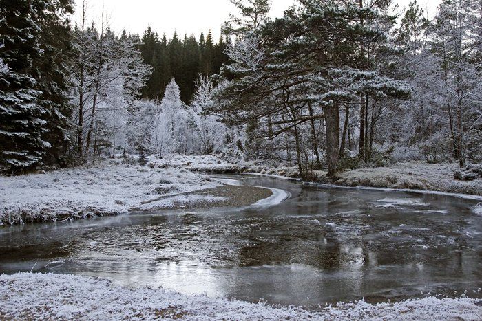
Stordalselva a cold winter's day where the ice has settled in quiet puddles and the hoarfrost hangs heavily on the trees.
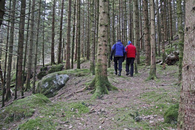
On a walk in the spruce forest in Høgåsen, before the forest was brought down after a storm.
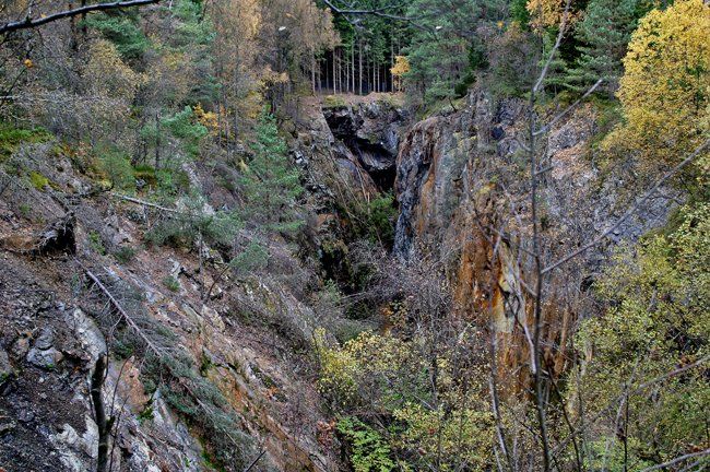
The large sinkhole in Høgåsen, 150 meters long, is impressive. It was here that kis extraction really began in the second half of the 19th century. Here seen from the south to the north.
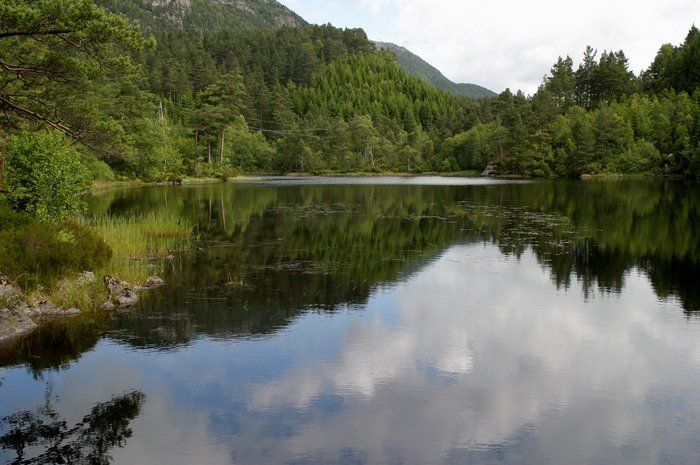
Jappaløkjen where the Washery fetched water for production. All photos Tor Resser ©